
2025–2026 U.S. Farmers’ Winter Forecast by State
- Kimi

- Aug 13, 2025
- 13 min read
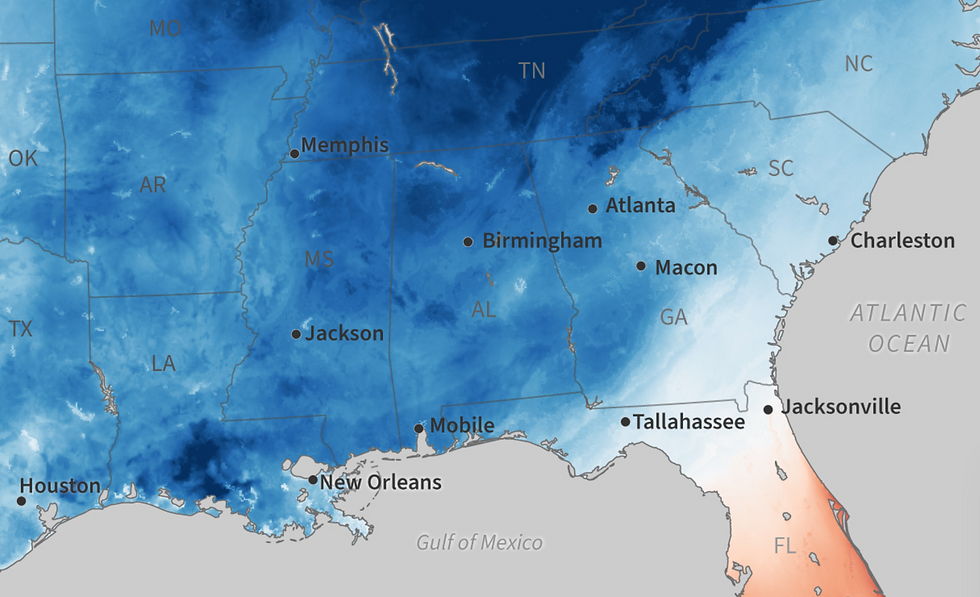
Alabama: Likely to experience a warmer-than-normal winter, coupled with relatively low rainfall. Below-average precipitation along the Gulf Coast could lead to drier soils and an increased risk of drought development if the expected dry pattern holds.
Alaska: Milder winter conditions are expected for much of Alaska, with above-average precipitation across the state. This means a healthy snowpack is likely (beneficial for spring water supply), although southeastern Alaska may see occasional colder spells compared to the rest of the state.
Arizona: Forecasts point to a warmer and drier winter than usual. Below-normal precipitation is likely, which means limited high-elevation snowfall and the possibility of worsening drought conditions if significant moisture doesn’t arrive.
Arkansas: A generally mild winter is expected, with temperatures running above average overall. Precipitation signals are not strong for Arkansas; near-normal moisture is plausible. This suggests winter rainfall should be roughly typical, providing some soil moisture but not indicating a major surplus or deficit (no clear drought relief or development is projected).
California: Anticipate a warmer winter, especially in southern California, with a tilt toward below-normal precipitation. The southern half of the state faces a 40–50% chance of drier-than-normal conditions, which could mean a thinner Sierra Nevada snowpack and the need for careful water management for agriculture.
Colorado: No strong temperature anomaly is projected (equal chances of warm or cold overall), but the southern Rockies region is expected to be drier than normal. Southern Colorado could see below-average snowfall and precipitation, potentially impacting winter wheat and reservoir recharge, whereas northern Colorado may see closer-to-normal moisture if more storms track further north.
Connecticut: A milder-than-usual winter is likely, but with above-average precipitation forecast for New England. This means frequent winter storms are expected – if temperatures allow, plenty of snow could fall. The abundant moisture should benefit water supplies, though warmer spells might turn some snow events into rain.
Delaware: Expected to have a warmer-than-average winter overall. Precipitation may run below normal, as Delaware lies in the “lower Mid-Atlantic” zone that tends to be drier in a La Niña-like pattern. Accordingly, snowfall might be limited and any ongoing dry conditions could persist without above-normal winter rain.
Florida: A significantly warmer and drier winter is on tap for Florida. The state faces a high probability of below-average precipitation (on the order of a 40–50% drier likelihood). With warmth and reduced rainfall, drought issues may emerge or continue, so irrigation will be crucial for winter crops.
Georgia: A warm, relatively dry winter is anticipated. Georgia falls into a part of the Southeast where below-normal precipitation is expected. Farmers might see fewer rain events and above-normal temperatures, which together could mean lower soil moisture and a need to monitor for developing drought.
Hawaii: Near-average to slightly wetter conditions are possible for Hawaii during early winter, although confidence is low. Some models predict an anomalously wet pattern for the Hawaiian Islands going into winter, especially if ENSO remains neutral, but given the uncertainty, the official outlook leans toward equal chances of wet or dry later in the season. Temperatures are generally expected to be above normal through late 2025, which could influence evaporation rates and crop growth.
Idaho: A wetter-than-normal winter is favored, particularly in eastern Idaho, which has elevated odds of above-average precipitation. This suggests a strong likelihood of ample mountain snowfall – good news for irrigation supply and spring runoff. Temperatures should be around normal for winter, with any La Niña development bringing periods of cold that bolster snowpack.
Illinois: The outlook calls for above-average precipitation, so Illinois can expect substantial winter moisture (likely in the form of both rain and snow). This should help replenish soil moisture. Because winter temperatures are projected to be milder than normal, especially in southern Illinois, some of that precipitation may fall as rain or ice rather than snow, which could affect how much snow cover persists.
Indiana: One of the regions with a strong signal for a wetter winter – Indiana is forecast to see higher than normal precipitation totals. This means plentiful moisture (heavy snowfall and/or rainfall) that could eliminate residual drought. Winter temperatures are likely to be above average, so bouts of rain or mixed precipitation are possible between snowstorms.
Iowa: No pronounced deviation is forecast for Iowa. Winter precipitation is expected to be near normal to perhaps slightly above normal, as the northern tier of the country in general leans wetter than average. Sufficient snowfall and rainfall should occur to maintain soil moisture. Temperatures will likely be at or a bit above the norm, with Iowa not singled out for extreme cold or warmth in the long-range outlook.
Kansas: A warmer, drier winter is predicted for Kansas. With the storm track projected to stay north of the central Plains, Kansas may receive below-normal precipitation, leading to limited snowfall and rainfall. Drought conditions are expected to persist or worsen without much winter moisture input, so winter wheat and other crops could face continued moisture stress.
Kentucky: A wetter-than-average winter is favored in Kentucky. NOAA’s outlook highlights the Ohio Valley (including Kentucky) as having elevated chances for above-normal precipitation, which should recharge groundwater and streams. Temperatures will trend warmer than normal, meaning winter storms might bring more rain or slush in lower elevations, though ample precipitation overall will benefit agricultural water needs.
Louisiana: A mild and notably dry winter is expected. Louisiana is among the Gulf Coast states with the highest likelihood of drier-than-average conditions this winter. Reduced rainfall could prolong or exacerbate drought in the region, so farmers should prepare for the possibility of water shortages and rely on irrigation where necessary.
Maine: A stormy winter is on the horizon – above-normal precipitation is forecast for Maine and the rest of New England. This means frequent snowstorms are likely, providing extensive snow cover and later spring meltwater. Despite the snowy outlook, average temperatures are expected to be warmer than normal overall, so intervals of milder weather could intersperse the cold stretches. Overall, ample snow should insulate winter crops and bolster water supplies.
Maryland: The state is projected to have a warmer-than-average winter season. Precipitation is roughly an equal chance of being above or below normal (no strong wet/dry signal) for the Mid-Atlantic corridor. In practical terms, Maryland should see fairly typical winter rainfall and occasional snow, providing near-normal moisture levels for agriculture. No extreme drought or surplus is foreseen at this time.
Massachusetts: Expect a milder winter in Massachusetts, with temperatures running above the long-term average. However, precipitation is likely to be above normal – translating to frequent winter storms. Many of those storms could be snow producers given sufficient cold episodes, potentially yielding above-average snowfall (especially inland). The abundant moisture will be advantageous for reservoirs and soil hydration going into spring.
Michigan: A wetter-than-normal winter is predicted for Michigan. This suggests considerable snowfall (and rain in milder periods), particularly in the lake-effect snowbelts. The moisture influx should alleviate any dry conditions and contribute to high spring soil moisture. With a generally warmer winter expected, southern Michigan may see more rain or mixed precipitation events, but northern areas should still accumulate hefty snow, benefiting winter grains and pastures by providing cover.
Minnesota: Minnesota can anticipate near to slightly above normal precipitation this winter, as storm tracks across the northern U.S. bring frequent snow opportunities. A decent snowpack is likely to develop, which will help recharge soil moisture when it melts. The state will still experience its typical Arctic cold spells (common in the Northern Plains), but overall temperatures may average just around normal or a bit warmer. The combination of periodic deep cold and regular snow should support winter hardy crops and delay any drought expansion.
Mississippi: A warmer and drier winter is on tap for Mississippi. The outlook for the Gulf states calls for below-average precipitation, so Mississippi may see fewer rain events than usual during winter. This lack of moisture could lead to emerging drought concerns if it persists. With higher-than-normal temperatures likely, any rainfall will come as rain (not snow), and overall soil moisture might decline without supplemental irrigation.
Missouri: No significant departure from normal is expected in Missouri’s winter. Temperatures should be milder than average like much of the southern Midwest. Precipitation is forecast to be about average (the central U.S. doesn’t have a strong wet or dry signal). Missouri should receive a mix of rain and snow typical for its winter climate, providing generally sufficient moisture for winter wheat and cover crops without extreme flooding or drought.
Montana: A snowy winter is likely in Montana. Above-normal precipitation is forecast, with central/northern Montana having a 40–50% chance of wetter conditions. This means enhanced mountain snowfall and prairie snowcover, which will boost water supplies and could improve any drought areas. Temperatures are expected to be around normal to occasionally colder than normal – consistent with La Niña patterns that bring cold to the Northern Rockies. Overall, Montana farmers can be optimistic about ample winter moisture stored in the snowpack.
Nebraska: Nebraska’s winter outlook is mixed. Overall, temperatures should be warmer than average, especially in southern Nebraska, following the warm central U.S. trend. Precipitation is projected to be near normal in the state. One long-range outlook hints at the possibility of wetter-than-normal conditions in western parts of the Plains, but confidence in that is low. For now, plan on roughly typical snowfall and rainfall. While no major drought relief is expected, conditions also aren’t predicted to dramatically worsen if near-normal precipitation occurs.
Nevada: A warmer-than-normal winter is anticipated for Nevada. Precipitation will likely be subpar, especially in southern Nevada, as the Southwest is forecast to be drier than average. Mountain snowfall in the Sierra Nevada and northern Nevada ranges may be limited, which could impact water availability downstream. Farmers and water managers should be prepared for reduced winter runoff and plan accordingly for irrigation needs in spring.
New Hampshire: An active winter is expected, with above-average precipitation across New England. For New Hampshire, this translates to frequent storms and plentiful snow, particularly in higher elevations. A solid snowpack is likely to form, providing moisture storage for spring. Winter temperatures will average warmer than normal, but despite the mild trend, significant cold snaps will still occur. Overall, ample snow and rain should keep water supplies healthy for farms.
New Jersey: New Jersey should see a milder winter than usual, with mean temperatures running above average. Precipitation has an equal chance of being normal, above, or below – in other words, no strong anomaly is indicated. The state will probably experience a typical mix of winter rain and occasional snow. There is no clear expectation of drought development or major flooding; winter moisture should suffice for agricultural needs, barring any extreme short-term events.
New Mexico: A generally warm, dry winter is on the horizon for New Mexico. The Climate Prediction Center outlook leans toward below-normal precipitation across the state, meaning less mountain snow and lower winter rain totals. This dry winter pattern could aggravate drought conditions in New Mexico. With reduced snowpack in the northern mountains, water resources may be strained by spring. Producers should brace for limited natural moisture and possibly plan for additional irrigation if available.
New York: Above-normal precipitation is expected, especially for upstate New York, as the Great Lakes and Northeast are favored to be wetter this winter. This suggests abundant snowfall in upstate and inland areas (and ample rain on milder days), which will recharge soils and reservoirs. Overall temperatures will likely be warmer than historical averages. Downstate New York (e.g., NYC and Long Island) might see more rain than snow with the warmer trend, but upstate farms should benefit from a hefty snowpack that provides spring moisture.
North Carolina: A milder and somewhat drier winter is projected for North Carolina. The state lies on the southern end of the storm track, so below-average precipitation is anticipated, particularly in southern and coastal NC. This could mean fewer significant snow or rain events. With warmth prevailing, any precipitation will mostly fall as rain. The downside is that if this dry pattern persists, soil moisture could decline and any drought in the region might not see much relief.
North Dakota: Expect a classic Northern Plains winter in North Dakota, with intermittent intense cold waves likely. Precipitation should be near to slightly above normal, as northern-tier states are generally tipped toward wetter conditions. That means ND could receive ample snowfall, which would be advantageous for spring moisture when it melts. The snow cover will also insulate winter crops like winter wheat. Overall, while drought has affected parts of the Plains, the anticipated snow and moisture should prevent significant worsening in North Dakota and may improve conditions in places.
Ohio: A notably wetter-than-average winter is forecast for Ohio. The state has one of the strongest wet signals in the country, so frequent precipitation events (snowstorms and rain) are expected. This should eliminate any dry soil conditions and fully recharge groundwater by spring. Temperatures are likely to run above normal, meaning many winter storms could bring rain or mixed precipitation in addition to snow. Farmers should be prepared for muddy fields at times, but the moisture will be beneficial for winter grains and cover crops.
Oklahoma: A warm, dry winter pattern is the prevailing outlook for Oklahoma. With the jet stream shifted northward, Oklahoma is expected to miss out on many big winter storm systems, resulting in below-normal precipitation. Drought is forecast to persist or even intensify in the southern Plains, including Oklahoma, over the winter. Producers should plan for scarce rainfall and limited soil moisture recharge, which may necessitate continued irrigation and could stress winter wheat.
Oregon: Cooler-than-normal conditions are actually possible in Oregon – the Pacific Northwest is one region with a chance of below-average winter temperatures. Early winter could see colder air and an early start to snowfall in the Cascades and eastern Oregon if La Niña develops. Precipitation is expected to be near or above normal, so plentiful rain and mountain snow are likely. A robust snowpack in Oregon’s mountains will be favorable for water supply, while valley farms might experience cool rains and reduced freeze damage due to the moderating influence of the Pacific.
Pennsylvania: A generally milder winter is expected in Pennsylvania, as in much of the Eastern U.S.. Precipitation should be about normal to a touch above. Northern and western Pennsylvania (the Allegheny and Appalachian regions) could see significant snowfalls during winter storms, especially in the mountains. By contrast, southern/eastern PA might get more rain with the warmer trends. Overall, the state should receive adequate winter moisture; heavy mountain snows will supply water, and no severe drought conditions are anticipated to develop.
Rhode Island: A warmer-than-normal winter is likely for Rhode Island. Meanwhile, the precipitation outlook for New England is wet – above-average precipitation is expected. This means Rhode Island can anticipate frequent wet weather. Some storms will be rain (given the mild tendencies), but heavy snow is still possible if cold air coincides with Nor’easters. Ample rainfall/snowmelt should keep reservoirs and soils in good shape for the start of the growing season.
South Carolina: A warmer and drier winter than usual is forecast for South Carolina. The southeastern U.S. is facing below-normal precipitation probabilities (on the order of 40–50% drier likelihood along coastal areas). As a result, South Carolina may see more clear, warm winter days and fewer soaking rains. If this holds true, soil moisture could decline and drought could creep in, so growers may need to monitor water availability for winter crops and early spring planting.
South Dakota: South Dakota should prepare for occasional harsh cold snaps (a common feature of Northern Plains winters), but overall winter temperatures might be near average. Precipitation is expected to be around normal for the season, with northern South Dakota potentially getting above-normal snowfall as the storm track favors the upper Midwest. A decent snow cover is likely, which is beneficial for soil moisture and protecting dormant crops. Drought conditions in the region are not expected to dramatically worsen and may improve slightly if the projected snow materializes.
Tennessee: Winter in Tennessee is projected to be milder than normal temperature-wise. Precipitation will probably be near the seasonal norm or even a bit above, since Tennessee lies just south of the especially wet Ohio Valley region. This means the state should get regular rain (and occasional snow in colder spells), providing sufficient moisture to avoid winter drought. Farmers can expect a mix of rainy days and some snow/ice, with overall adequate soil moisture by winter’s end.
Texas: The official outlook leans toward a warmer, drier winter for Texas. Most of Texas, especially central and southern areas, has elevated odds of below-normal precipitation and above-normal temperatures, typical of a La Niña-type pattern. Accordingly, widespread winter drought persistence is a concern. (Notably, the Farmers’ Almanac suggests the possibility of multiple cold, wet spells in Texas and neighboring states, with frequent cold rains and even some ice. However, this scenario is considered low-confidence by meteorologists, and the overall expectation is for dryness.) In summary, Texas farmers should plan for limited natural rainfall and continue drought mitigation strategies, while staying alert in case a few surprise winter storms bring localized relief.
Utah: The state is likely to see a warmer-than-normal winter, particularly in southern Utah. The precipitation outlook tilts drier – Utah is part of the southern Rockies region expected to receive below-average precipitation. This could result in a subpar snowpack in Utah’s mountains, which is crucial for spring and summer water supply. Northern Utah might fare closer to normal if some Pacific storms reach that far, but overall, farmers should be aware that winter moisture may be less abundant than usual.
Vermont: A snowy winter is anticipated in Vermont, thanks to above-normal precipitation across New England. Frequent snowstorms should build a deep snowpack in Vermont’s high country and valleys alike, providing excellent spring runoff for farms. Despite the snowy pattern, average temperatures will likely be on the warmer side of normal, meaning thaws could punctuate the winter. Still, the net effect is plenty of winter moisture to recharge the ground — a positive for Vermont’s agricultural water needs.
Virginia: A milder winter is expected for Virginia, with overall temperatures above the long-term mean. The southern part of Virginia falls into a drier winter pattern (the “lower Mid-Atlantic”), so below-normal precipitation is projected there. Northern Virginia may see closer to normal moisture. In practical terms, Virginia might have fewer significant snowstorms and more modest rain events. Without an excess of winter precipitation, current drought conditions (if any) could linger, but on the flip side, no major flooding issues are foreseen either.
Washington: Washington is one of the few states with a chance of colder-than-normal conditions this winter. The outlook suggests that the Pacific Northwest, including Washington, could see below-average temperatures and an early onset of winter weather. This bodes well for a robust mountain snowpack – plenty of snow is likely in the Cascades and eastern Washington if frequent storms materialize. Precipitation should be near or above normal, so even lower elevations will get ample rain. For agriculture, a cold, wet winter means good water supply later on, though farmers should prepare for potential cold stress on livestock and delayed spring field access due to heavy snowmelt.
West Virginia: Winter temperatures in West Virginia are expected to be above average, but that doesn’t rule out significant snow in the mountains. In fact, precipitation should be near normal to slightly above, and the Appalachian mountain counties could see periodic heavy snowfalls. Higher elevations are likely to receive accumulating snow that will melt into abundant spring moisture. Lower elevations and the western part of the state may get more rain than snow during milder periods. Overall, water availability for farms should be sufficient, and winter wheat should have enough protection and moisture.
Wisconsin: A wetter winter is on tap for Wisconsin, as the Great Lakes states are forecast to be wetter than average. Frequent snowfall (and occasional rain) is expected, which will build up snow cover and improve soil moisture by spring. This is beneficial for the region’s agriculture, easing any drought concerns. Temperatures might be a bit warmer than normal in southern Wisconsin, but the state will still get its share of cold winter weather and snowpack. Farmers can count on a good supply of winter moisture, which should set up pastures and spring planting with adequate ground water.
Wyoming: Wyoming should see an active winter with above-normal precipitation, particularly in the northern parts of the state. This implies heavier snowfall in the mountains and plains – a boon for water resources. Skiers and ranchers alike can be optimistic, as experts note that Wyoming (along with Montana) is positioned for plentiful snow this season. Temperatures will be around average, with likely spells of deep cold (typical for the region) but no enduring extreme warmth to wipe out the snow. Overall, a snowy winter in Wyoming will help alleviate drought and fill reservoirs, benefiting agriculture come spring.
